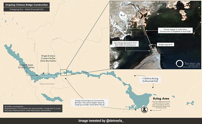
China is building a second bridge across the Pangong Tso lake, according to the Ministry of External Affairs, not far from one of the most sensitive places in the border standoff that began in May 2020.

According to accounts, the second bridge, which is currently under construction, is a permanent structure. A prior bridge, which appeared in January, seems to have been constructed to make work on the present one easier. This second bridge, once completed, will allow armoured vehicles to pass quickly between the north and south sides of the Pangong Tso.
After completing the first bridge on the Pangong Tso – about 400 metres long and 8 metres wide – near the lake’s friction zones on the north bank and the Chushul sub-sector on the south bank a few months ago, China began work on a larger bridge adjacent to it.
According to India, the bridge lies about 20 kilometres east of Finger 8 on the lake’s north bank, which is where the Line of Actual Control (LAC) runs. However, the road distance between the bridge location and Finger 8 is more than 35 kilometres.
The building location is located just east of Khurnak Fort, a historic ruin where China maintains key border defence outposts. It’s known in China as Rutong Country. It has a border defence company at Khurnak Fort and a water squadron at Banmozhang farther east.
Despite the fact that it is being built on land that China has controlled since 1958, the specific location is only west of India’s claim line, indicating that India considers it its own territory. Last Monday, the Ministry of External Affairs said that China has unlawfully annexed the land.
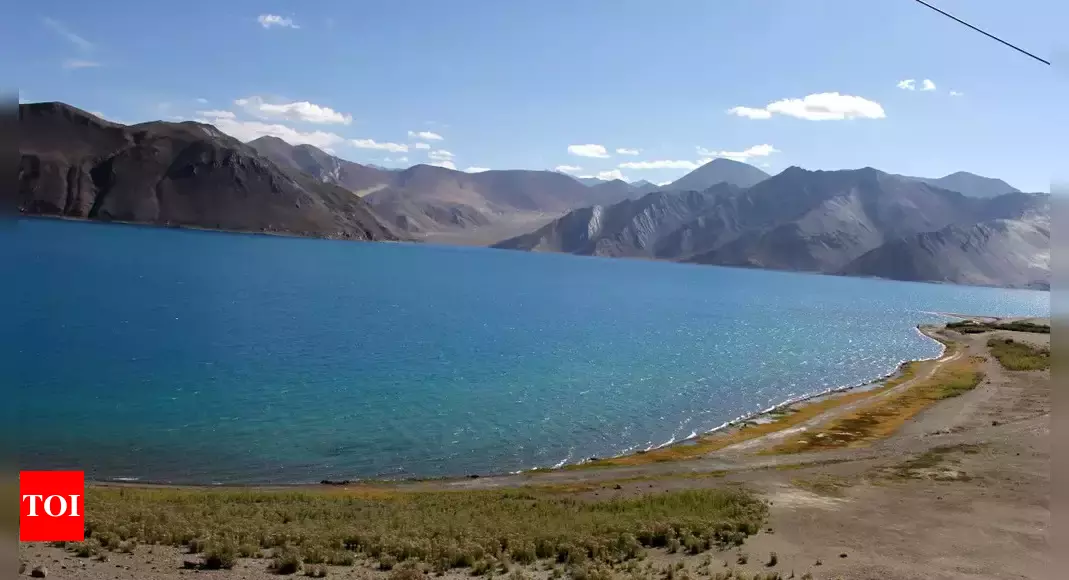
Pangong Tso is a landlocked lake with a length of 135 kilometres. India controls around 45 kilometres of the Pangong Tso, while China controls more than two-thirds. The new bridge will be built around the midway point of the boomerang-shaped lake.
The bridges’ primary goal is to allow troops, notably mechanised forces, heavy weaponry, and military equipment, to travel more quickly. The bridges are located near the LAC, at one of the lake’s narrowest places.
The developments are a direct result of the continuing stalemate, which began in May 2020 and prompted both parties to build infrastructure along the 3,488-kilometer-long LAC.
The site has to do with an operation carried out by the Indian Army in August 2020, which gave India some negotiating power in the impasse. The Indian army outmanoeuvred the People’s Liberation Army to take control of the Kailash Range in the Chushul sub-sector on the Pangong Tso’s south bank.
The positions gave India control of the strategically important Spanggur Gap, which could be utilised to mount an attack like China did in 1962. India also has a clear view of China’s Moldo Garrison. The Chinese were quite concerned about this.
Following this action, the Indian Army repositioned themselves on the lake’s north bank, over Chinese troops. In May 2020, the north bank was one of the initial grounds of contention.
Warning shots were fired by both sides for the first time in almost four decades during this scuffle. Troops and tanks were also positioned just a few hundred metres apart in certain spots on the south bank, creating a hazardous eyeball-to-eyeball standoff.
After spending a tough winter on those heights, the two sides ultimately agreed to withdraw soldiers from these places in February of last year.
Officially, India has stated that China is occupying the bridge site illegally and that it is closely monitoring any Chinese work.
While numerous issues of contention have been handled, three more are being discussed.
